Where is it?
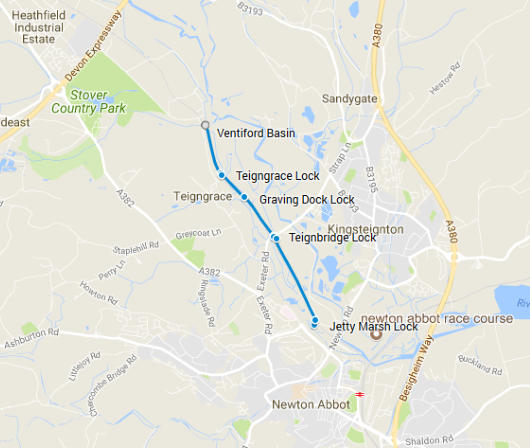
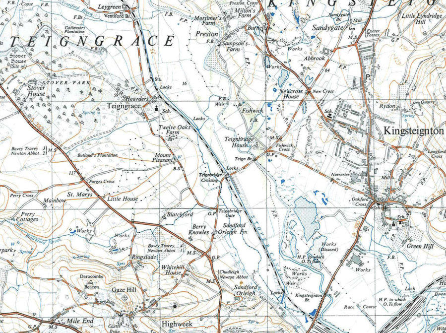
The Stover Canal can be found in South Devon, to the west of Kingsteignton. It runs for nearly 2 miles from north of Teigngrace to the outskirts of Newton Abbot. The map below is reproduced from the Ordnance Survey 1904-33 edition map. © Crown Copyright 2008. It clearly shows the canal running alongside the railway line. Phase 1 of the restoration plan concentrated on the section from Teignbridge Crossing near the centre of the map down to the Locks at the bottom of the map.
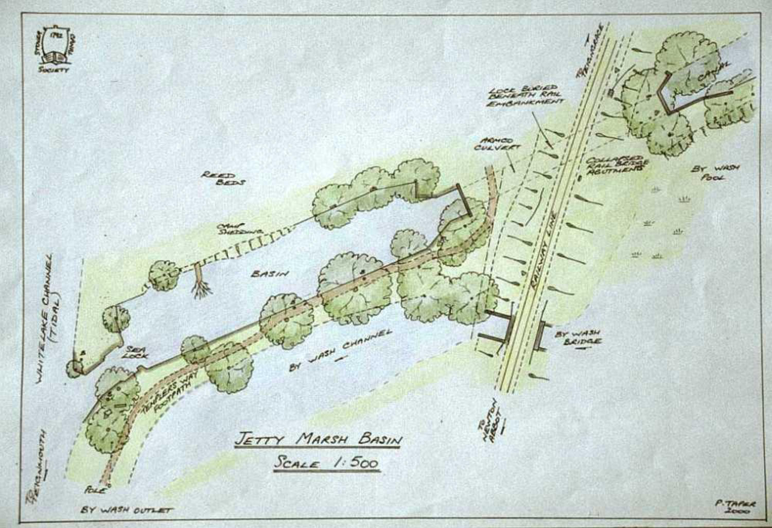
As built, the canal was 1.9 miles (3.2 km) long and included five locks which are detailed below. It was supplied with water from three feeders, one from Ventiford Brook, a stream which also supplies Stover Lake and one from the River Bovey at Jewsbridge, both of which fed the top pound, and one from the River Teign at Fishwick, which entered the canal just below Graving Dock Lock. The exit from the canal was through Jetty Marsh Lock on to the tidal Whitelake channel, and from there to the River Teign and the docks.
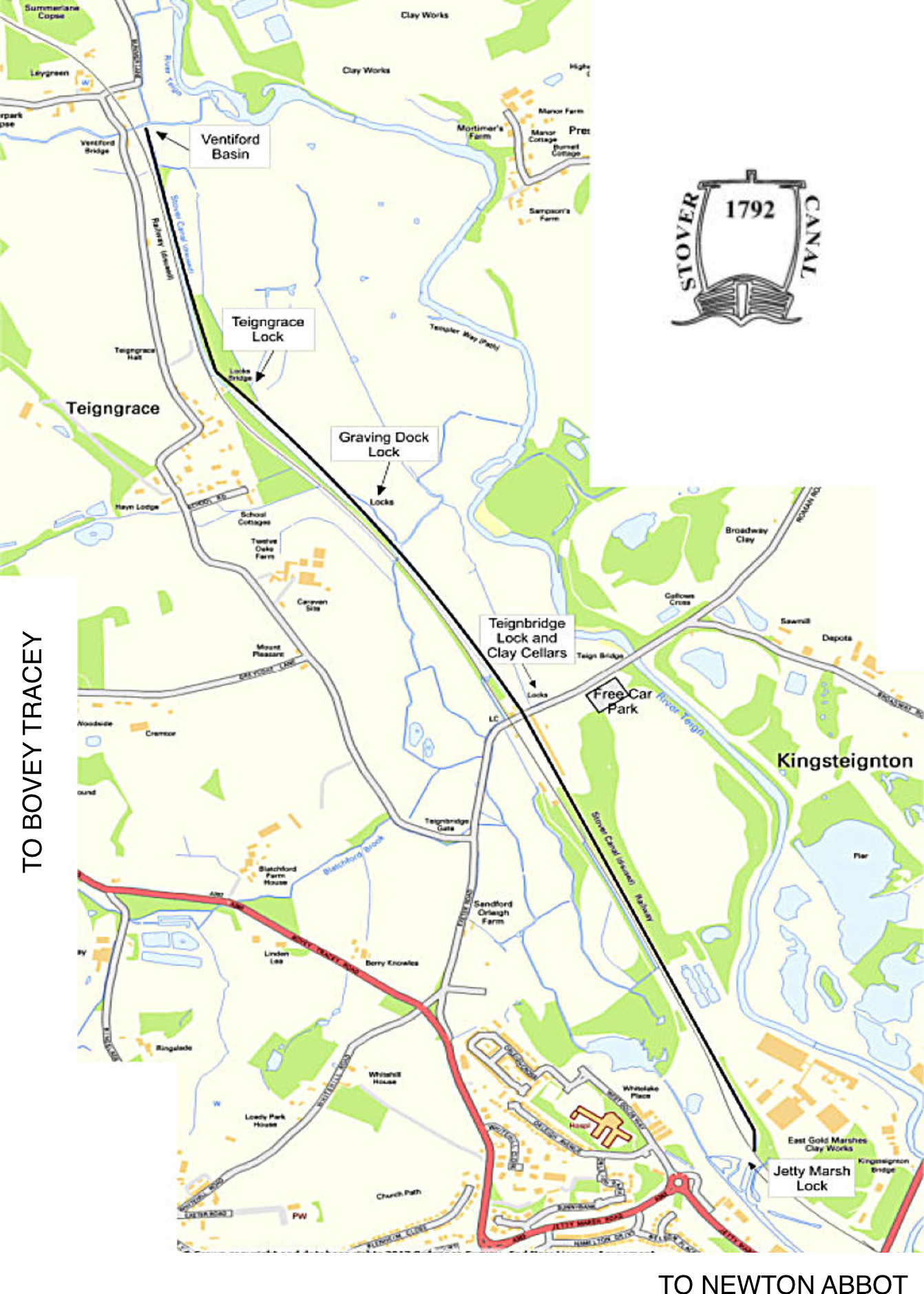
Ventiford Basin
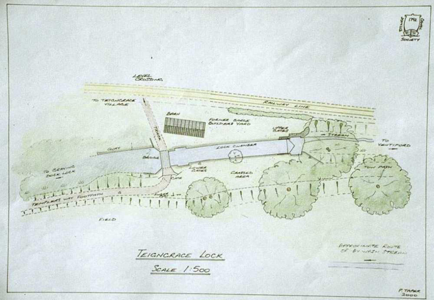
Teigngrace Lock
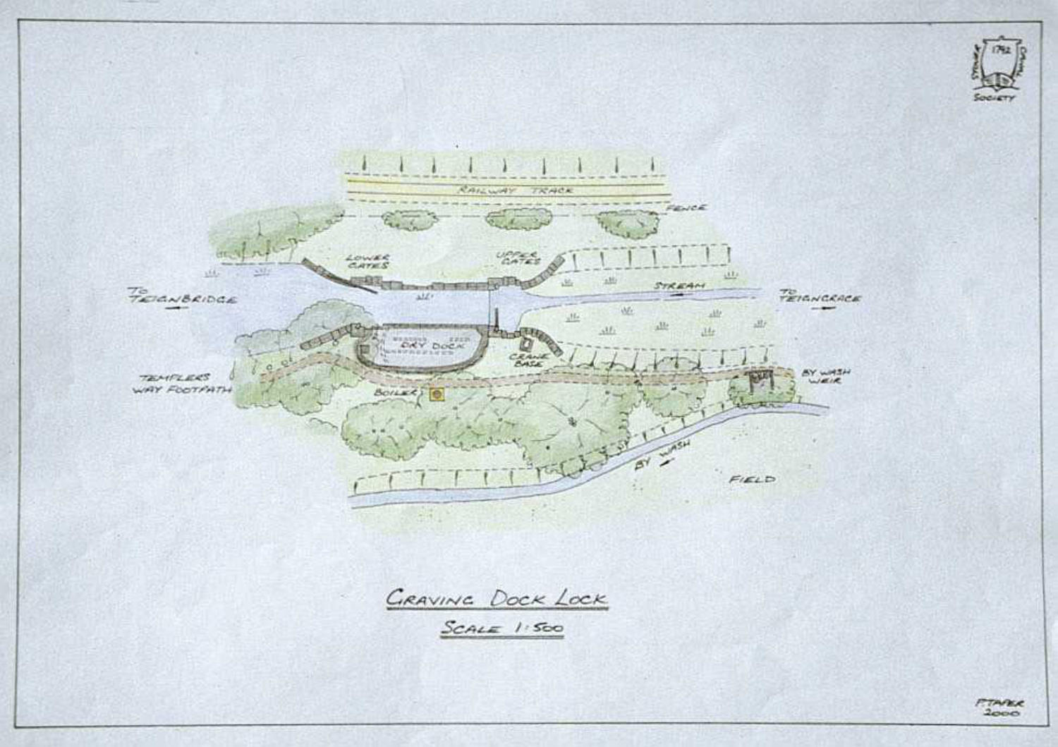
Graving Dock Lock
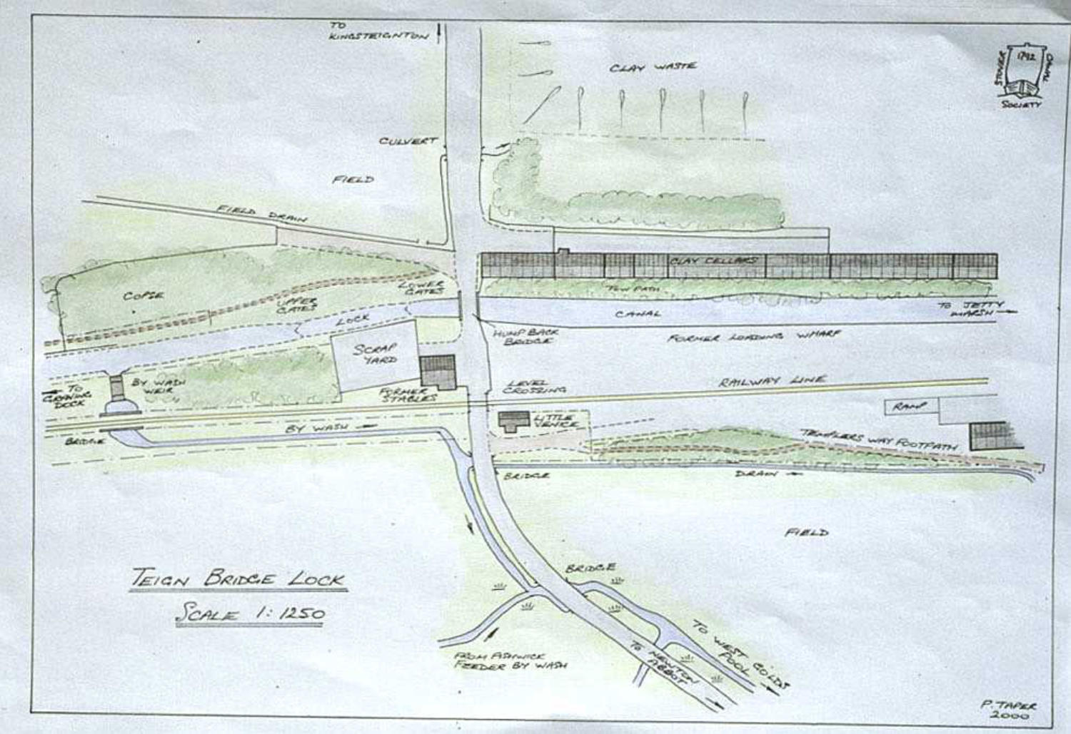
Teignbridge Lock and Clay Cellars
Jetty Marsh Lock